Great features to enhance utilization
Ensurvi offers powerful tools designed to simplify inspections, enhance accuracy, and streamline your entire workflow from start to finish.
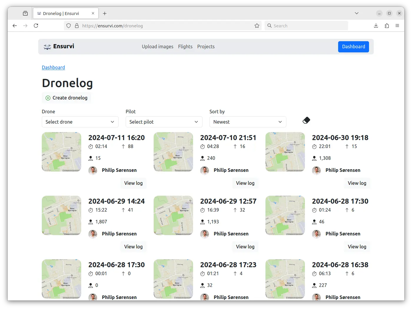
Complete overview of previous flights.
Complete overview of your dronelogs
Upload log files from your remote controllers to the platform for automatic processing. This provides a detailed overview of your flights, where you can click on each log to get a detailed presentation of your flight logs.From the overview you also have the option to filter on drone and drone pilot.
View details of previous flights
Each dronelog can be viewed where details from the flight are displayed in a nice overview.Learn more about dronelogs
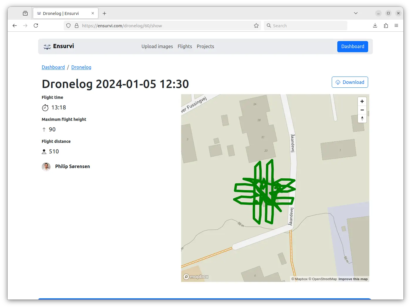
Detailed view of a previous flight.

Legacy dronelogging
Documentation through fleet management
Ensurvi provides an overview of all your drones and makes it easy to keep track of documentation. Upload invoices, insurance papers, certificates and so on for your drones. All information about your drone at your fingertips. When viewing a drone, you get the complete overview of where it has flown (with drone logs), who's using it, and all the relevant documents.Read more about fleet management
Automatically generate detailed orthomosaics
The platform automatically generates orthophotos from the images uploaded. Simply upload your images and the platform will start generating orthophotos from your flights. The orthophotos can be as detailed as 1 GSD (ground sample distance).Learn more about orthophotos
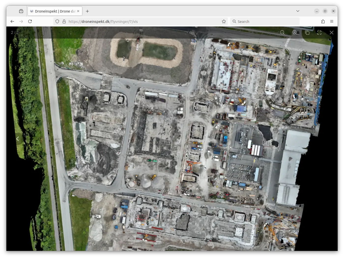
A detailed orthophoto from a construction site.
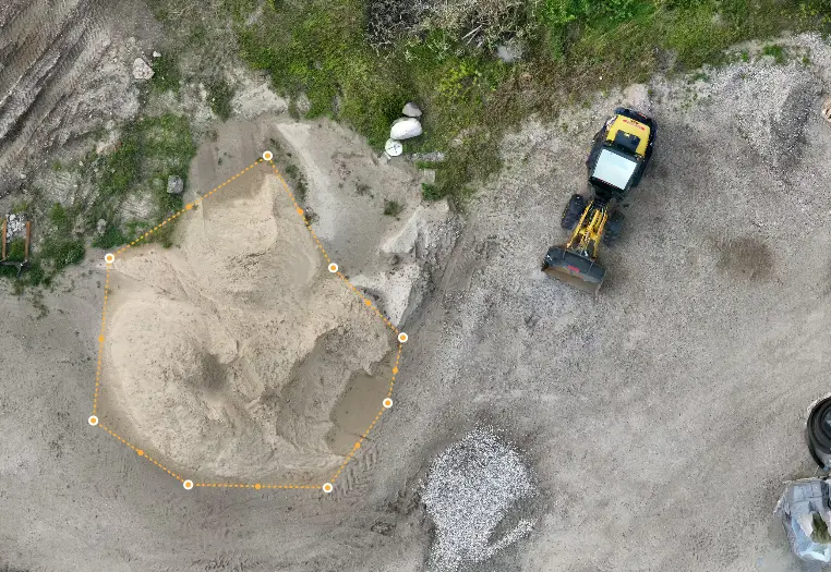
Easy measurement of materials based on drone images.
Volume measurement with drones – precise and efficient measurement of piles and materials
Do you need to know the exact amount of soil, gravel, or other materials on a construction site or stockpile? With drone-based volume measurement, you quickly and safely get a detailed overview that both saves time and provides you with accurate data for planning and settlement.Read more about volume measurement
Bring your projects to life with stunning 3D models
Our platform transforms drone data into detailed 3D models, giving you an entirely new perspective on your assets and projects. By using advanced photogrammetry and processing techniques, we turn aerial imagery into accurate, high-resolution 3D representations. Simply upload your images and the platform will start processing high-quality 3D models of your inspection areas. Easily view, analyze, and share detailed models directly from your dashboard.Visualization of a 3D model
Get more out of your drone flights with Ensurvi.
Are you ready to take your drone usage to the next level?
Try Ensurvi today and get more out of your flights than ever before. Save time, reduce errors, and deliver high-quality inspection reports with confidence — every time you use Ensurvi.
Start a free trial