Used by 2,000+ drone pilots and inspectors
Professional drone software for inspections and drone logging
Online platform for ground and drone mapping, progress tracking and site documentation.
Get started See more featuresFeatures
Advanced drone solutions for modern construction projects
We offer a wide range of functions that make your work easier, faster and more accurate. Explore advanced features such as automatic mapping, precise measurements and detailed analysis
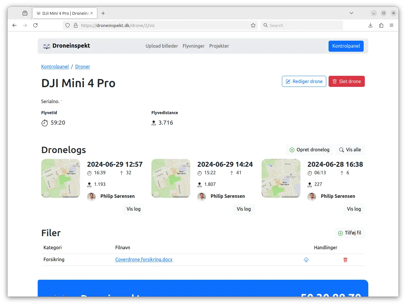
Well-organized documentation
Ensurvi provides an overview of all your drones, pilots, and makes it easy to keep track of documentation.
Read more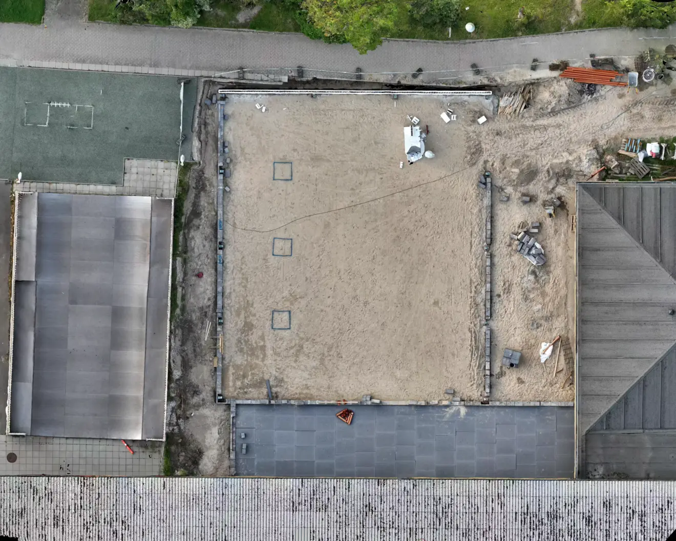
Orthophoto
Get a sharp and detailed overview of your construction projects with orthophotos.
Read more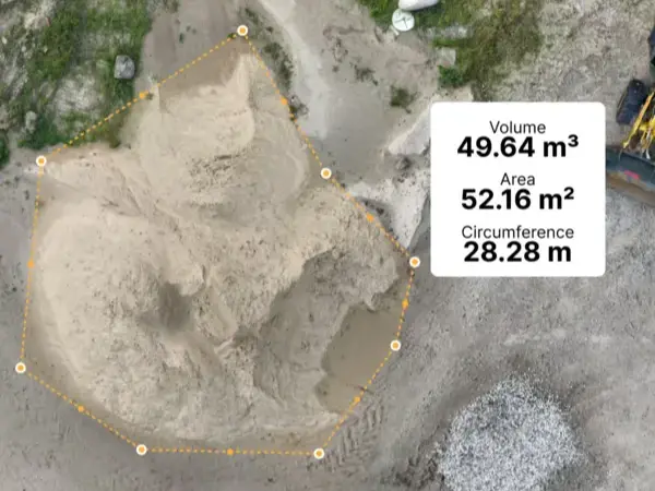
Volume measurement
With Ensurvi you can quickly turn drone data into precise volume measurements. Get full overview of materials, stockpiles, or terrain – without manual effort and with high accuracy.
Read moreFull control of your drone flights
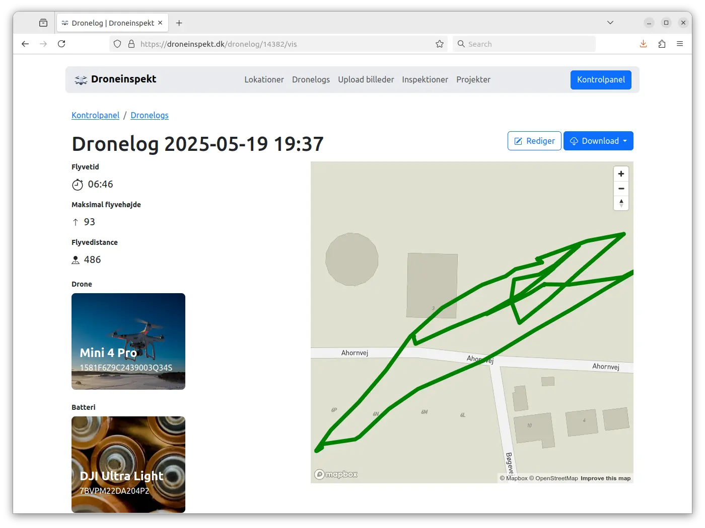
Automatic logging, visual overviews, and export-ready reports
Our platform makes it easy to keep track of your drone logs. All your flights are logged automatically, giving you a complete overview of dates, locations, durations, and pilots – right at your fingertips. No more manual entries or messy Excel sheets. Whether you fly as a private pilot or within a larger organization, we help you document and ensure the quality of your operations.Read more
Pricing
Flexible price packages for all needs
Get access to the market's best drone software without breaking the budget. Our pricing packages offer great value and flexibility so you can find a solution that matches your needs and goals.
All prices excluding VAT
Contact us
Probably the friendliest support team
Address
Webudvikleren ApSVAT: DK43635050
Aakandevej 4
8920 Randers NV
Denmark

Blog
Follow the developments at Ensurvi
Drones make it faster, safer and more accurate to inspect buildings, infrastructure and accessible areas. See how companies are leveraging this technology to optimize their workflows.
Efficient Drone Volume Measurement – Accurate Data for Construction Projects
Discover how drone-based volume measurement delivers fast, safe, and highly accurate calculations of materials like soil, gravel, and waste.
Read the post
Battery Status in Ensurvi – Keep Track of Your Drone Batteries
Ensurvi automatically shows battery status from your drone logs. Track wear, lifespan, and performance – and plan replacements in time.
Read the post