Volume measurement with drones – precise and efficient measurement of piles and materials
Do you need to know the exact amount of soil, gravel, or other materials on a construction site or stockpile? With drone-based volume measurement, you quickly and safely get a detailed overview that both saves time and provides you with accurate data for planning and settlement.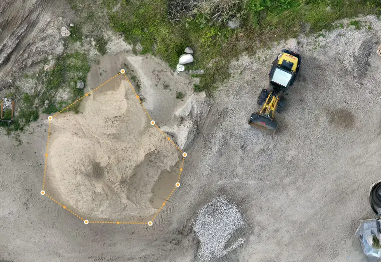
What is drone-based volume measurement?
When working with large quantities of materials such as soil, gravel, stone, waste, or biomass, it is important to have precise volume measurements. Traditional methods often require a lot of manual work and can be time-consuming – and in some cases also unsafe.With drone-based volume measurement, we can quickly and accurately calculate volumes from aerial photos and 3D models. This means you get an exact overview of quantities in a short time and without complicated land surveying.
Typical use cases
Drone-based volume measurement can be used in many different industries. The most common are:- Construction and civil engineering projects – calculation of earthworks, fill, and control of delivered materials.
- Raw material extraction – ongoing measurement of gravel pits, quarries, and stockpiles.
- Waste and recycling sites – documentation and monitoring of quantities over time.
- Agriculture and food industry – measurement of silos, silage, and other large storages.
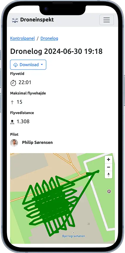
How the measurement works
The process is simple and efficient.Advantages of volume measurement with drones
There are many reasons to choose drone surveying over traditional methods:- Time-saving – large areas can be covered in just minutes.
- Accurate – precision down to a few centimeters.
- Safe – no employees need to move around on potentially dangerous piles or terrain.
- Cost-effective – surveys can be repeated regularly without major additional costs.
- Visual overview – with 3D models and maps you get a clear picture of your materials.
Frequently Asked Questions (FAQ)
Here you can find answers to the most common questions about drone-based volume measurement – from accuracy and time usage to pricing and possibilities.
Accuracy depends on the area and the type of materials, but in most cases we can deliver results with precision down to a few centimeters.
The actual drone flight can often be completed in under an hour, depending on the area size. Data processing and reporting typically take 1 working day. After that, you can make as many measurements as you want.
Your data is securely stored on a web server in Frankfurt, Germany. In addition, encrypted backups are kept at multiple locations in Scandinavia. All data storage takes place within the EU and complies with current data protection regulations (GDPR), so you can rest assured that your information is handled responsibly and securely.
The price depends on which package you choose. See all our packages and prices here: Prices.
Get started with precise volume measurement
Do you want a precise and efficient overview of your materials? With Ensurvi you get professional volume measurement that saves time, increases safety and gives you precise data for planning and billing.Get started